Artifact type: Operational design case study
Audience: Infrastructure planners, engineers, and wayfinding designers
Purpose: Demonstrates translating real-world constraints into implementable wayfinding requirements.
Train Station Wayfinding System Modernization
Overview
This project redesigned the wayfinding system for a major multimodal train station serving regional rail, intercity rail, local transit, park-and-ride facilities, shuttle services, taxis, cyclists, and pedestrians.
The goal was to reduce passenger confusion, improve platform navigation, and align signage with real-world operational constraints across multiple transportation agencies.
The work required translating planning concepts and observed passenger behavior into implementable signage specifications for engineering teams and contractors.
The completed project later earned multiple industry awards recognizing its improvements to multimodal connectivity and transit infrastructure.
My Role
I contributed documentation and operational analysis supporting the station's wayfinding modernization.
Responsibilities included:
- Conducting passenger and employee research to identify navigation challenges
- Observing pedestrian flow patterns during train arrivals and departures
- Documenting operational constraints affecting signage placement
- Translating planning concepts into implementable wayfinding requirements
- Assisting engineering teams in refining signage placement based on operational realities
- Supporting procurement documentation and RFP preparation for signage implementation
Problem
Passengers frequently became disoriented within the station due to overlapping transportation services and unclear platform guidance.
The station presented a unique operational challenge:
two platforms served the same track, but trains opened doors on only one side to maintain passenger flow. This often left riders waiting on the wrong platform to board, creating ongoing uncertainty.
Planning documents described intended passenger circulation but did not fully capture how passengers navigated the station during live operations.
As a result, signage needed to account for:
- Real-world passenger behavior
- Multimodal transfers between services
- Operational responsibilities of multiple agencies
Research and Observation
To understand navigation failures, the project combined qualitative research and field observation.
Activities included:
- Passenger and staff interviews
- Observation of pedestrian movement during train landings
- Mapping common navigation errors and hesitation points
- Reviewing existing signage placement and terminology
These observations revealed several points where passengers consistently paused, reversed direction, or sought assistance.
In practice, the project applied information architecture and user experience (UX) principles to a physical environment, treating signage and spatial cues as an information system guiding passenger decision-making.
Operational Constraints
The station operates as a shared environment involving multiple transportation providers and public agencies.
Signage decisions needed to account for operational requirements from:
- Regional rail operators
- Intercity rail
- Airport transportation services
- Local bus and shuttle operators
- Station security and law enforcement
- Nearby businesses affected by passenger circulation
Additional operational considerations included curb access, passenger pickup areas, and parking enforcement zones.
Wayfinding needed to support both passenger navigation and the ability of station staff and law enforcement to manage vehicle and pedestrian flow.
In addition, the project required compliance with grant funding requirements and public infrastructure regulations, which influenced signage standards, procurement processes, and documentation.
Solution
The resulting system introduced a clearer signage hierarchy designed to support faster passenger decision-making.
Key improvements included:
- Clearer directional guidance for the bidirectional platform
- Improved transfer guidance between rail, local transit, and other station access modes
- Signage improving navigation to station facilities and services
- Color-coded and labeled parking areas to help passengers remember where they parked
- Signage placement aligned with observed passenger movement patterns
- Visual consistency with the station's historic color palette
The final design reflects a coordinated multimodal wayfinding system that improves passenger orientation across rail platforms, parking areas, station facilities, and surrounding access points while preserving the station's architectural character.
Final Signage Implementation
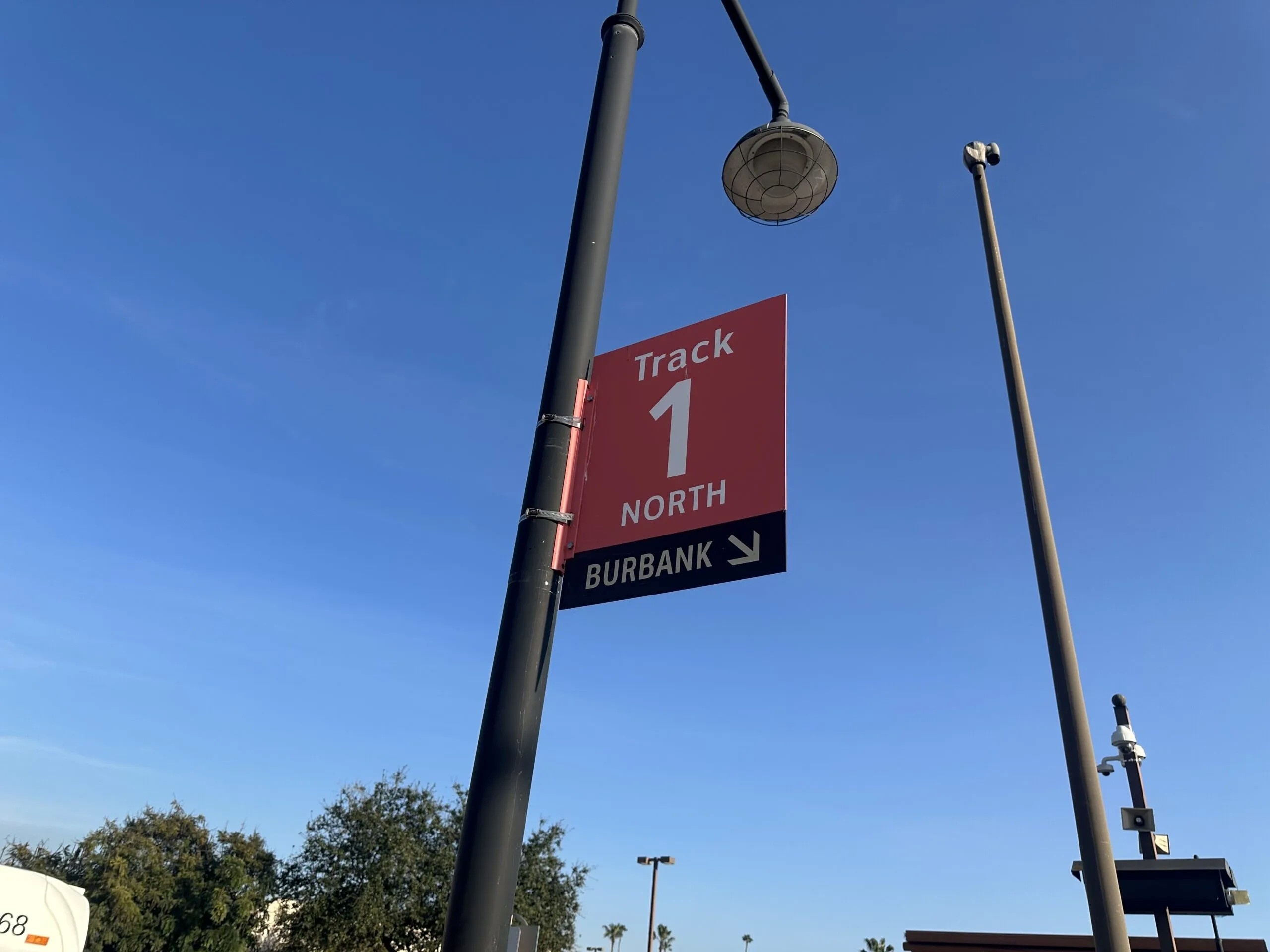
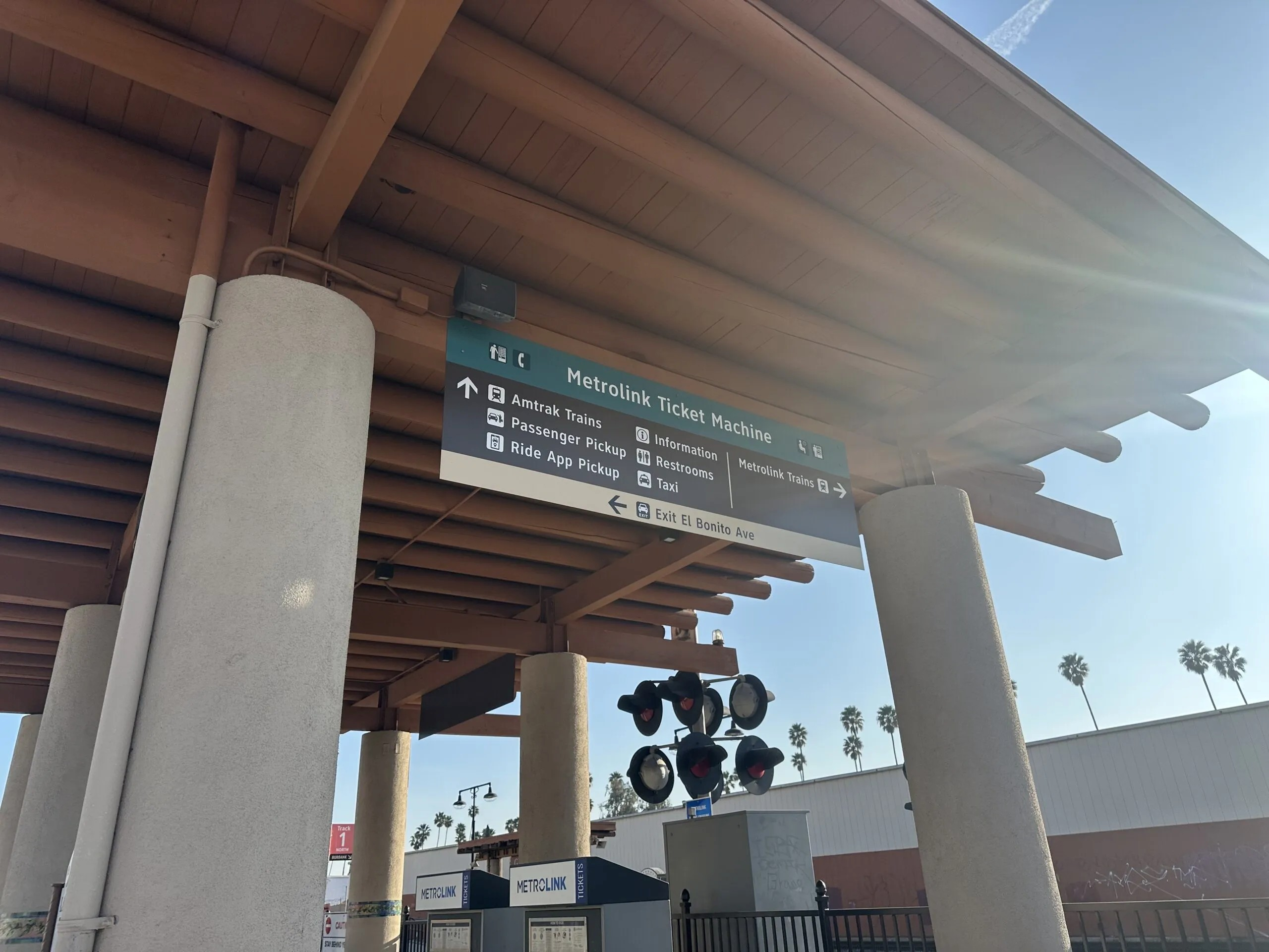
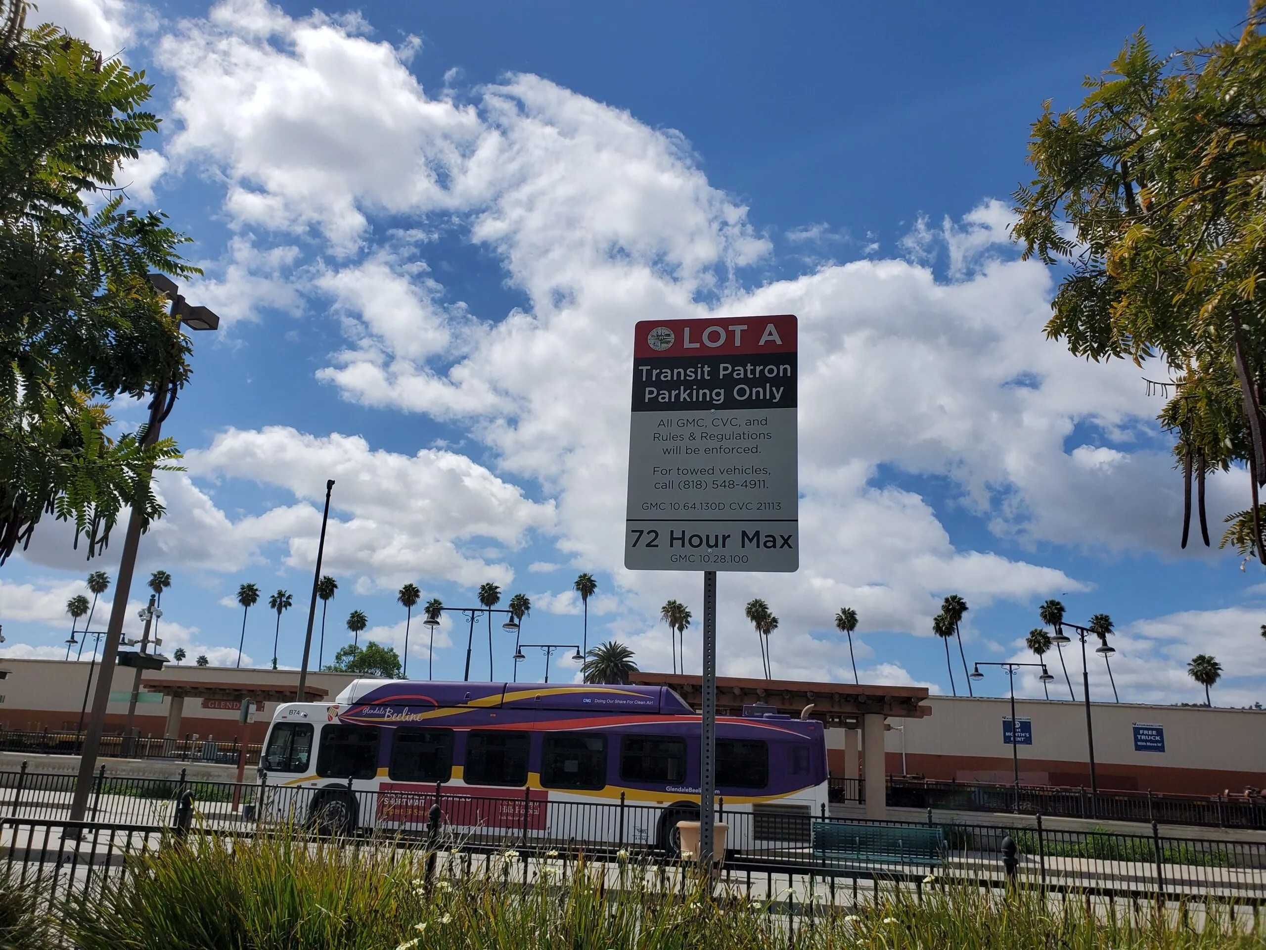
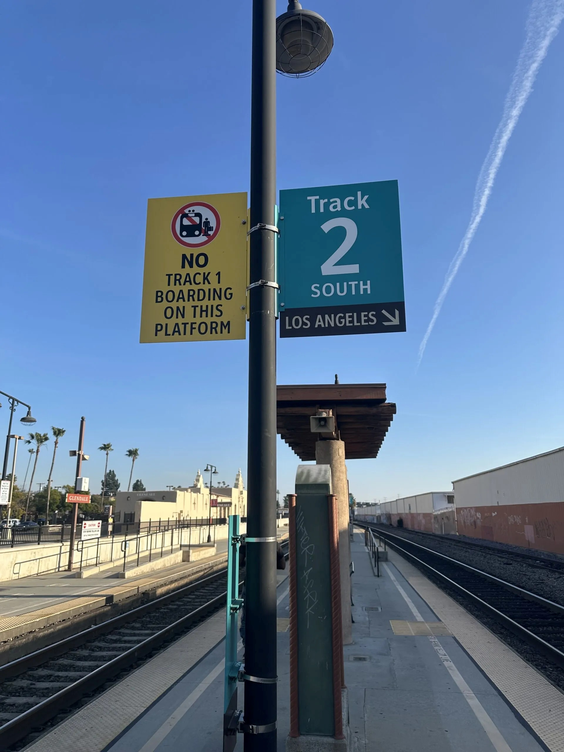
Selected examples of installed wayfinding signage implemented as part of the station modernization project.
Skills Demonstrated
This project demonstrates several technical documentation competencies:
- User research and observational analysis
- Translating operational constraints into implementable requirements
- Information architecture and navigation design
- Cross-agency requirements gathering
- Supporting procurement documentation (RFP development and execution)